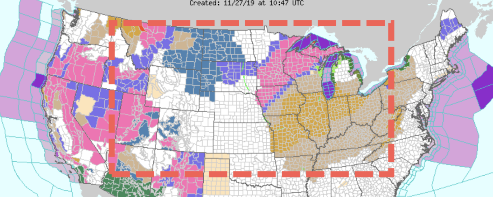
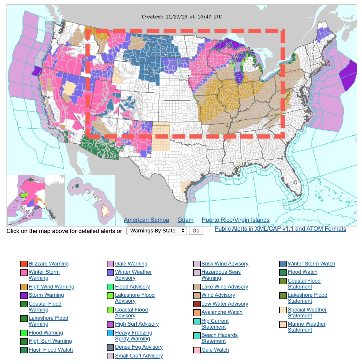
(Zero Hedge) A pre-Thanksgiving snowstorm has already traversed the Central Plains toward the upper Midwest. The storm is producing dangerous weather conditions during one of the busiest driving days of the year, reported NBC News.
Related Winter MADNESS: Is This Thanksgiving a Preview of the Bitterly Cold Winter to Come?
by Staff Writer, November 27th, 2019
Winter Storm Dorothy dumped 7 to 12 inches of snow late Monday into Tuesday across Denver.
Winter storm warnings and winter weather advisories have already been posted for many regions in the Central Plains and upper Midwest on Wednesday.
Heavy snow and winds are expected for parts of the upper Mississippi Valley into the northern Great Lakes Wednesday. Blizzard-like conditions could make driving unsafe ahead of holiday travels.
Here's a look at where Winter Storm #Dorothy will be tracking today. @FeliciaCombsTWC & I will detail how much snow will add up. Oh and BTW…there's another storm (#Ezekiel) behind it. We've got the forecast…9am-1pm ET on the @weatherchannel. pic.twitter.com/ds1Fxbgvjy
— Alex Wallace (@TWCAlexWallace) November 26, 2019
Dorothy is expected to dump nearly a foot of snow across central Nebraska to western and northern Iowa, southeastern South Dakota, southeast Minnesota, northern Wisconsin and the Upper Peninsula of Michigan by late evening.
“It’s going to be bad,” said Todd Krause, a National Weather Service (NWS) meteorologist.
“The snow is going to come down hard. It’s going to come down fast,” Krause said. “Visibility is going to be very, very poor during the height of the snowstorm.”
Strong winds from the winter storm could lead to airport delays, damaged infrastructure, power outages, and snowdrifts across the Midwest and Great Lakes.
“Strong winds will contribute to more blowing and drifting snow in these areas, resulting in dangerous travel conditions,” NWS said.
Buy Book The pH Miracle: Balance Your Diet, Reclaim Your Health
The storm will then move towards the Northeast on Thursday could produce high winds in New York City, possibly grounding the iconic floats seen at the Macy’s Thanksgiving Day Parade. Temperatures will be in the 50s on Thursday, with winds sustained above 20 mph, could gust up to 35-40 mph.
In the West, a “bomb cyclone” has made landfall in the mountain areas of Oregon and Northern California.
Here's a satellite look at the "bomb cyclone" that will be moving into the area over the next few hours. Hopefully everyone is prepared for strong, significant storm today! #orwx #cawx pic.twitter.com/hJwblDOEgO
— NWS Medford (@NWSMedford) November 26, 2019
Blizzard conditions are expected for elevated regions in southern Oregon and Northern California through Thanksgiving.
Tens of millions of people are expected to travel Wednesday-Thursday for the holiday season. Several parts of the US will experience fierce weather that may make it unsafe to drive.
Stillness in the Storm Editor: Why did we post this?
The news is important to all people because it is where we come to know new things about the world, which leads to the development of more life goals that lead to life wisdom. The news also serves as a social connection tool, as we tend to relate to those who know about and believe the things we do. With the power of an open truth-seeking mind in hand, the individual can grow wise and the collective can prosper.
– Justin
Not sure how to make sense of this? Want to learn how to discern like a pro? Read this essential guide to discernment, analysis of claims, and understanding the truth in a world of deception: 4 Key Steps of Discernment – Advanced Truth-Seeking Tools.
Stillness in the Storm Editor’s note: Did you find a spelling error or grammar mistake? Send an email to [email protected], with the error and suggested correction, along with the headline and url. Do you think this article needs an update? Or do you just have some feedback? Send us an email at [email protected]. Thank you for reading.
Source:


Leave a Reply